
Visit To Hawaii - Page 4
 Welcome to Diamond Head! It's morning and we plan to make our way to the top of the caldera. You can see the look of grim determination on our faces.
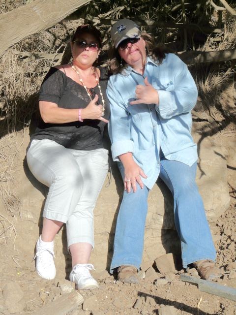 Yeah, we can do this!
 As we made our climb, we were passed by a couple of teams of 20-something military students running up the and down the trails leading to the caldera. I remember those days, and now I'm paying for them in my 'old age'. In this picture, Karen is literally standing over the edge of the caldera.
 Saying that this stairwell looks like a steep climb, is an understatement. We counted every one of those 99 steps each way, both on the way up and back down.
 How high are we up? 703.556 feet, according to this step on the 99 stairs...
 Well, we thought that the stairs would be the last hurtle, but there was more ahead of us. Thankfully, there were places where we could stop and rest on the way up.
 And wouldn't you know it, there was another set of stairs to deal with. At this point, we stopped so Luann could catch a breather.
 Yeah, at 127 steps, this was even tougher.
 Unfortunately, we caused something of a backup behind us as we made our way up the stairwells...
 Next, we had to go through this tunnel. Of course, we paused a bit before going on. As a bit of levity, and because the tunnel was cut through the rock like a mine shaft, I decided to sing the song from the 7 Dwarfs. You know, "Heigh-Ho, Heigh-Ho, it's off to work we go!"
We had a bunch of people giggling with that one.
 As if the stairs and tunnel weren't enough of a challenge, next was a circular stairwell. When Luann put her foot on the first step, she called back to the people behind us; "I hope nobody has 'virgin ears' behind us, because I'm about to let loose with a couple of swear words!" And justifiably so.
 So, now we made it up to the inside of the 'Pill Box', which is still not at the top. There was guy set up in here selling "I Made It To The Top" documents to show you actually did make it. You know I had to get one for Luann.
 Here we are, signing the logsheet of the geocache we found, located on Diamond Head. And you know what, we still aren't at the top yet...
 Ah, finally! We made it all the way to the top, and what a view!
 We could see all of Waikiki from here.
 As a matter fact, there is the marina where we went geocaching, the enclosed lagoon at the back of the Hilton hotel and the L-shaped reef Dave and I snorkled off of to the left.
 A little bit past the marina is the lagoon of Magic Island, located at the end of Ala Moana Beach Park.
 And in this shot, all the way from Diamond Head, shows the Ilikai hotel where are staying. It's the hotel in the middle with the teal balconys. This hotel is significant because if you watch the opening credits of the original Hawaii 5-0 TV series, you will see a shot where they zoom in on Steve McGarret and he is standing at a balcony of the Ilikai.
 Yeah, he was standing here.
 We even had a great view of the Diamond Head Lighthouse too.
 Well, we made our way back down to the surface level, whereby we treated ourselves to some shaved ice to cool off. Luann had lemon-lime which is green (naturally), while I had coconut, which was... blue???
 After winning over Diamond Head, Dave said he had another place he would like to show us at Makapu'u. On the way there, we stopped off at Lana'i Lookout and when I looked at my GPS, there was a geocache 460 feet from where I was standing, so off I go!
 This is a picture of me at the edge of the road I was scaling along, before finding out that I needed to cross the road.
 Found it! I had to climb down into this little grotto to get to it.
 And when I turn around, there was this cave right in front of me. How did I miss that on the way to the cache?
 I just had to go back up to the overlook and tell everybody what I found, and after getting chewed out by Karen & Luann because they were hollering down the precipice thinking that I fell off the wall, Dave & Karen decided to come back to the cave with me. Here we are, starting down the passage.
 Well, waddaya know? It was a tunnel, not a cave!
 It goes up underneath the road and comes out below the spot where I was scaling along the guardrail.
 And here we are.
 I couldn't help but to sit down and take a couple of pictures of our surroundings.
 I tell you, there is no way we could have made it this close to the water without that tunnel.
 It must have taken some time to burrow this out. Well, it's time to head back before Luann becomes worried.
 Dave went first...
 And Karen told me to get this shot, saying that Luann would understand when she saw it.
 Next was a trip to Makapu'u, so we could get a picture of the lighthouse there.
 Oh, the things we do to get the picture...
 Time to break out the cameras and record where we've been!
 Alright! We made it to the lighthouse! We were able to get quite a few nice images of this fine example.
 Up at the top, there was this lonely plaque telling about the crash of a PBY-5A aircraft that was on patrol a couple of months after the Pearl Harbor attack. Apparently, they thought the lighthouse on Makapu'u was Barbers Point Lighthouse and ended up hitting the mountain nearby.
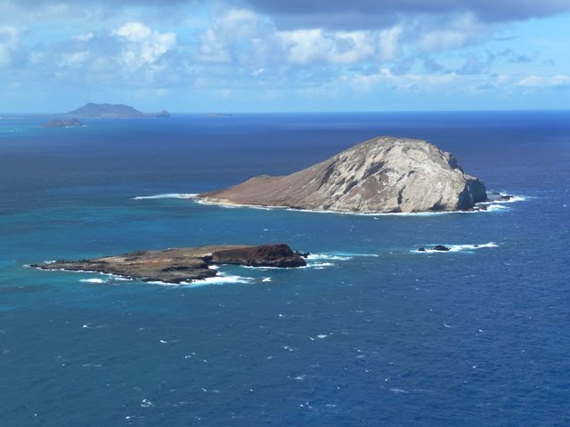 Here's a view of 2 islands, the first is Manana Island, also known as Rabbit Island (the bigger one) and the smaller island is Kaohikaipu Island, also known as Turtle Island.
 From up here, you have a great view of Makapu'u Beach Park and the coastline. This area is supposed to have been the backdrop for the Magnum P.I. TV series.
 After our two treks of the day, the girls settled down at the hotel while Dave and I chased down a virtual geocache that took us down the Waikiki Historic Trail. It started here (at position #5 on the map at the above website) with "The Duke", a beloved representative of Oahu.
 Next was Prince Jonah Kuhio Kalanianaole, also known as "The Prince Of The People".
 We came across these surfboard markers all along our way. If you want to know what is printed on them, Click Here for more information.
 This bronze statue portrays a popular children's story, involving Lila & Makua (a monk seal and a boy, respectively). The story is said to honor Hawaiian values of love & respect for Ohana (family) and the ocean. It seems as though visitors like to rub the seal's head for good luck.
 This bronze statue is titled: Surfer On A Wave. There isn't much about this statue on the 'net, other than it was made by a local, but the confusing amount of statues just placed anywhere, can sometimes seem to be without rhyme or reason. Sadly, it looks like they don't run the fountain on this sculpture anymore.
 This is a good example of what I mean. This statue of Queen Kapi'olani is not placed in a position of honor, nor is there anything around here that suggests it is of 'Queenly' status. To further prove my point is a statue of Mahatma Gandhi in front of the Honolulu Zoo (which was a part of the virtual cache requirements) that makes it seem like Waikiki went bronze-crazy, once upon a time.
 How about a draonfly? Or a little girl prancing across the lawn? Too much bronze and not enough reasons for them to be there.
 Now, deeper in the city, this statue makes more sense as it is placed on land that formerly belonged to Princess Ka'iulani and the plaque explains a bit about her life. She was known as the Peacock Princess and a movie was made of her life too.
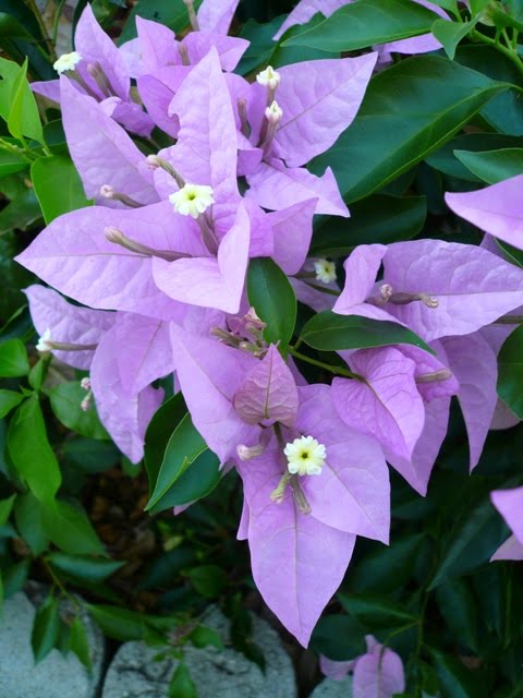 Next, was a jaunt to Queen Kapi'olani's Garden of which there was a geocache at the site and of course, we took photographic advantage of the flowers there.
 Here is a white hybiscus, which is the State Flower (regardless of color).
Thursday - 09/09/10
 This morning we decided to visit the USS Arizona Memorial. This is a plaque that is placed at the memorial site, right by the flagpole mounted over the sunken ship.
 Yep, just like this...
Now, there were a ton of things to see, and we took over 300 pictures. Unfortunately, there's no way I could put them all on this page.
 Just past the flagpole, you can see a mounting ring for one of the gun turrets of the sunken USS Arizona.
 Behind the flagpole is this pipe that was cut with a torch. Inside are a bunch of cables and ladder too. I kind of wonder if this pipe was an accessway to another part of the ship.
 Another view of the gun turret mount, called a barbette.
 A picture of the USS Missouri from the Arizona Memorial. You can see parts of the Arizona still above the water, and the white float depicts where the Arizona ends. Yeah, waaaay out there...
 This view shows the deck of the Arizona. It is so spooky to know that so many sailors died in her and are still down there.
 On this side is one of the piers that was welded to the Arizona's superstructure.
 This wall in The Shrine Room enumerates the names of the sailors that went down with the Arizona. On each side of the velvet ropes are marble sections with the names of the survivors that chose to have their remains interred within the Arizona when they died.
 When we made it back to the staging area, we stopped to get a picture of Karen's hat. She received this from a soldier that was serving in Iraq.
 This is something of a look back over our shoulder at the Arizona Memorial and 'Mighty Mo' standing watch over her fallen comrade.
 Another neat thing here is the USS Bowfin submarine, and near the Bowfin is a museum and gift shop that caught our interest.
 Yeah, a suicide torpedo, all in the name of war.
 Dave inpected the inside of a subarine control center, and surprisingly, many of the switches, dials and indicators seemed to work.
 There were a couple of periscopes mounted and you could see pretty well through these.
 I was able to get a shot through the viewfinder with my camera.
 Just before we left, we just had to get a picture or two of the flowers here...
 Friday - 9/10/10
Oh darn! Our Hawaiian Holiday is over and it's time to wave goodbye to Oahu and board the plane. At least we aren't going directly home and will be stopping by Arizona for a little geocaching first.
Saturday - 9/11/10
 So, here we are, at the South Mountain Preserve on September 11th, ten years since the attack on the World Trade Center towers. We came across a mini-tribute placed by this park bench at a scenic overlook.
 What a view from up here!
 Hey, look at me! Karen took this picture while I was deciding if I really wanted to go down into the gully to get a multi-cache... Naaah!
 While I scrambled down to another cache that was closer, Luann and Karen checked out the outlook post.
 I see you, seeing him!
 This brass compass dais points to objects of interest that are visible from here.
 And where is it located? At Dobbins Lookout! There were some things we had to do to get the earthcache here, but we completed the requirements.
 Found it! I had to do some climbing to get to this one.
 Luann got this neat picture of this lizard.
 And thankfully, Karen took a picture of a saguaro cactus, which we didn't because we have seen so many of them before.
 I got a picture of this Common Chuckwalla lizard. I didn't see him crawl into the crack as much as I had heard him.
 We also toured the area around this decrepit building in Scorpion Gulch. There was supposed to be a geocache there, but we couldn't find it.
 Here is a plaque we came across in our wanderings.
 Here-here!
 Ah, our family tree-hugger gets one last squeeze in before we head back to the airport.
 And now, we're finally heading home. It was a busy time in Hawaii, but boy! We did alot!
posted by The Nieborgs | 9/05/2010 02:14:00 AM
![]()
![]()
0 Comments:
Post a Comment
Subscribe to Post Comments [Atom]
<< Home